Gia Nghĩa
Gia Nghĩa | |
|---|---|
| Gia Nghĩa City Thành phố Gia Nghĩa | |
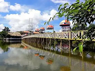 A tourist area in Gia Nghia city | |
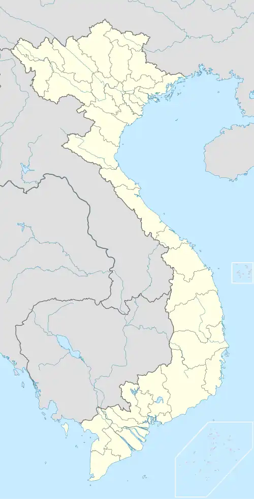 Gia Nghĩa Location of Gia Nghĩa in Vietnam | |
| Coordinates: 11°59′N 107°42′E / 11.983°N 107.700°E | |
| Country | |
| Province | Đắk Nông Province |
| Established | 2004 |
| Area | |
• Total | 284.11 km2 (109.70 sq mi) |
| Population (2019) | |
• Total | 85.082[1] |
| Time zone | UTC+7 (Indochina Time) |
Gia Nghĩa is the Provincial city of Đắk Nông Province, in the Central Highlands of Vietnam. It is located on the main road northward to Buôn Ma Thuột.[2][3]
Name
Its present name Gia Nghĩa from the original name in Jarai language: Yăgrai (means "the water dragon"). It was changed by President Ngô Đình Diệm's policy in 1957.
Climate
| Climate data for Gia Nghĩa, elevation 660 m (2,170 ft) | |||||||||||||
|---|---|---|---|---|---|---|---|---|---|---|---|---|---|
| Month | Jan | Feb | Mar | Apr | May | Jun | Jul | Aug | Sep | Oct | Nov | Dec | Year |
| Record high °C (°F) | 33.5 (92.3) |
35.7 (96.3) |
37.1 (98.8) |
37.1 (98.8) |
35.6 (96.1) |
33.5 (92.3) |
33.0 (91.4) |
33.0 (91.4) |
33.2 (91.8) |
32.4 (90.3) |
33.0 (91.4) |
32.9 (91.2) |
37.1 (98.8) |
| Mean daily maximum °C (°F) | 28.4 (83.1) |
30.5 (86.9) |
31.9 (89.4) |
31.9 (89.4) |
30.6 (87.1) |
28.9 (84.0) |
28.3 (82.9) |
28.0 (82.4) |
28.4 (83.1) |
28.7 (83.7) |
28.0 (82.4) |
27.0 (80.6) |
29.2 (84.6) |
| Daily mean °C (°F) | 20.5 (68.9) |
21.8 (71.2) |
23.3 (73.9) |
24.2 (75.6) |
24.2 (75.6) |
23.6 (74.5) |
23.1 (73.6) |
23.0 (73.4) |
23.1 (73.6) |
22.8 (73.0) |
22.2 (72.0) |
20.8 (69.4) |
22.7 (72.9) |
| Mean daily minimum °C (°F) | 15.2 (59.4) |
15.8 (60.4) |
17.8 (64.0) |
19.6 (67.3) |
20.9 (69.6) |
20.8 (69.4) |
20.5 (68.9) |
20.6 (69.1) |
20.4 (68.7) |
19.5 (67.1) |
18.6 (65.5) |
16.8 (62.2) |
18.9 (66.0) |
| Record low °C (°F) | 7.6 (45.7) |
7.8 (46.0) |
9.5 (49.1) |
13.2 (55.8) |
17.0 (62.6) |
16.6 (61.9) |
17.1 (62.8) |
17.0 (62.6) |
16.2 (61.2) |
11.4 (52.5) |
10.7 (51.3) |
8.3 (46.9) |
7.6 (45.7) |
| Average rainfall mm (inches) | 16.6 (0.65) |
34.6 (1.36) |
101.7 (4.00) |
171.7 (6.76) |
271.6 (10.69) |
319.4 (12.57) |
397.2 (15.64) |
439.1 (17.29) |
400.9 (15.78) |
256.7 (10.11) |
78.1 (3.07) |
20.3 (0.80) |
2,511 (98.86) |
| Average rainy days | 2.8 | 4.3 | 10.2 | 14.8 | 22.2 | 24.6 | 26.8 | 28.0 | 26.8 | 21.1 | 9.7 | 3.9 | 196.3 |
| Average relative humidity (%) | 76.1 | 74.5 | 75.7 | 80.4 | 85.5 | 88.8 | 88.5 | 90.2 | 89.9 | 86.3 | 82.5 | 79.0 | 83.1 |
| Mean monthly sunshine hours | 251.3 | 240.6 | 250.4 | 222.7 | 190.2 | 146.3 | 142.3 | 126.5 | 125.9 | 163.6 | 193.4 | 223.5 | 2,279 |
| Source: Vietnam Institute for Building Science and Technology[4] | |||||||||||||
Transport
In terms of air travel, Gia Nghĩa does not have its own airport with the nearest airports located in neighbouring provinces: Buon Ma Thuot Airport in Đắk Lắk which is approximately 126 km and Lien Khuong International Airport in Lâm Đồng which is approximately 156 km from Gia Nghĩa.
Gallery
-
 Cao nguyên Mơ Nông, Đắk Nông.jpg Mơ Nông Plateau, Đắk Nông
 -
 TX.Gia Nghĩa, Đắk Nông..jpg National Highway 14 section through Gia Nghĩa city
 -
 Trải nghiệm Thác Gia vĩ.jpg
References
Wikivoyage has a travel guide for Gia Nghĩa.
- ^ ONLINE, TUOI TRE (2019-12-30). "Kể từ 1-1-2020, thị xã Gia Nghĩa lên thành phố". TUOI TRE ONLINE (in Vietnamese). Retrieved 2023-06-08.
- ^ Jonathan D. London Education in Vietnam 2011 Page 178 " The development of the newly established province can be seen in the dramatic changes in Gia Nghĩa. In 2004, it was a small rural town that functioned only as a stopover station along a busy traffic route northward to Buôn Ma Thuột. By the time of a return in 2007, there was fresh construction everywhere, roads were expanded ....."
- ^ ONLINE, TUOI TRE (2019-12-30). "Kể từ 1-1-2020, thị xã Gia Nghĩa lên thành phố". TUOI TRE ONLINE (in Vietnamese). Retrieved 2023-06-08.
- ^ "Vietnam Institute for Building Science and Technology" (PDF).
11°59′N 107°42′E / 11.983°N 107.700°E
| Đắk Lắk province |
|  |
|---|---|---|
| Đắk Nông province | ||
| Gia Lai province | ||
| Kon Tum province | ||
| Lâm Đồng province | ||
※ denotes provincial seat. | ||