Gesse
| Gesse | |
|---|---|
 | |
.png) | |
| Location | |
| Country | France |
| Physical characteristics | |
| Source | |
| • location | Arné |
| • coordinates | 43°09′17″N 00°28′00″E / 43.15472°N 0.46667°E |
| • elevation | 550 m (1,800 ft) |
| Mouth | Save |
• coordinates | 43°26′04″N 00°51′06″E / 43.43444°N 0.85167°E |
• elevation | 175 m (574 ft) |
| Length | 52.1 km (32.4 mi) |
| Basin features | |
| Progression | Save→ Garonne→ Gironde estuary→ Atlantic Ocean |
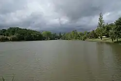
The Gesse (French pronunciation: [ʒɛs]; Gascon: Gessa) is a 52.1 km (32.4 mi) long river in the Hautes-Pyrénées, Haute-Garonne and Gers départements, southwestern France.[1] Its source is at Arné, on the plateau de Lannemezan. It flows generally northeast. It is a left tributary of the Save into which it flows at Espaon.
Départements and communes along its course
This list is ordered from source to mouth:
- Hautes-Pyrénées: Arné
- Haute-Garonne: Boudrac
- Hautes-Pyrénées: Bazordan
- Haute-Garonne: Saint-Loup-en-Comminges, Nizan-Gesse, Gensac-de-Boulogne, Blajan, Boulogne-sur-Gesse, Péguilhan, Lunax, Nénigan, Saint-Ferréol-de-Comminges, Puymaurin, Molas
- Gers: Tournan
- Haute-Garonne: Boissède
- Gers: Cadeillan, Sabaillan, Sauveterre, Espaon,
References