Garsellakopf
| Garsellakopf | |
|---|---|
 | |
| Highest point | |
| Elevation | 2,105 m (6,906 ft) |
| Coordinates | 47°10′13″N 9°33′53″E / 47.17028°N 9.56472°E |
| Geography | |
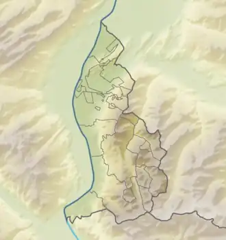 Garsellakopf Location in Liechtenstein, on the border with Austria | |
| Location | Liechtenstein / Austria |
| Parent range | Rätikon, Alps |
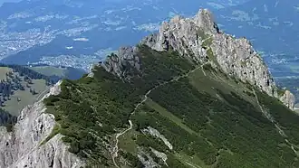
Garsellakopf is a mountain on the border of Liechtenstein and Austria in the Rätikon range of the Eastern Alps to the east of the town of Schaan, with a height of 2,105 metres (6,906 ft).
References
- Unfolding Liechtenstein, Panorama Map (Map). Liechtenstein Tourismus. 2007.
- Feldkirch - Vaduz (Map). 1:50000. Wander, Bike- und Skitourenkarte. Cartography by Kompass-Karten GmbH. Kompass. 2007.