Furnace Run (Youghiogheny River tributary)
| Furnace Run Tributary to Youghiogheny River | |
|---|---|
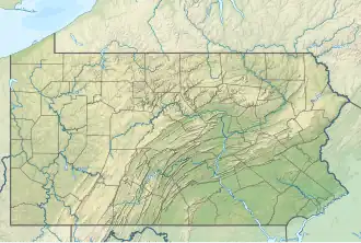 Location of Furnace Run mouth  Furnace Run (Youghiogheny River tributary) (the United States) | |
| Location | |
| Country | United States |
| State | Pennsylvania |
| County | Fayette |
| Physical characteristics | |
| Source | Allen Run divide |
| • location | Buena Vista, Pennsylvania[2] |
| • coordinates | 40°01′16″N 079°42′30″W / 40.02111°N 79.70833°W[1] |
| • elevation | 1,290 ft (390 m)[2] |
| Mouth | Youghiogheny River |
• location | about 1 mile west of Dawson, Pennsylvania[3] |
• coordinates | 40°03′25″N 079°41′28″W / 40.05694°N 79.69111°W[1] |
• elevation | 839 ft (256 m)[3] |
| Length | 2.70 mi (4.35 km)[4] |
| Basin size | 3.19 square miles (8.3 km2)[5] |
| Discharge | |
| • location | Youghiogheny River |
| • average | 4.78 cu ft/s (0.135 m3/s) at mouth with Youghiogheny River[5] |
| Basin features | |
| Progression | Youghiogheny River → Monongahela River → Ohio River → Mississippi River → Gulf of Mexico |
| River system | Monongahela River |
| Tributaries | |
| • left | unnamed tributaries |
| • right | unnamed tributaries |
| Bridges | Goth Road, PA 201, Virgin Run Road, Hawk Road (x3) |
Furnace Run is a 2.70 mi (4.35 km) long 2nd order tributary to the Youghiogheny River in Fayette County, Pennsylvania.
Course
Furance Run rises in Buena Vista, Pennsylvania,[2] and then flows northeast to join the Youghiogheny River about 1 mile west of Dawson.[3]
Watershed
Furnace Run drains 3.19 square miles (8.3 km2) of area, receives about 43.0 in/year of precipitation, has a wetness index of 348.92, and is about 67% forested.[5]
Natural History
Furnace Run is the location of Furnace Run Confluence BDA, which contains a scour area and a mature riverine forest as well as a rare plant species.[6]
References
- ^ a b "GNIS Detail - Furnace Run". geonames.usgs.gov. US Geological Survey. Retrieved 21 November 2020.
- ^ a b c "Get Maps". USGS Topoview. US Geological Survey. Retrieved 21 November 2020.
- ^ a b c "Get Maps". USGS Topoview. US Geological Survey. Retrieved 21 November 2020.
- ^ "ArcGIS Web Application". epa.maps.arcgis.com. US EPA. Retrieved 21 November 2020.
- ^ a b c "Furnace Run Watershed Report". US EPA Geoviewer. US EPA. Retrieved 21 November 2020.
- ^ "Fayette County Natural Heritage Inventory" (PDF). Pennsylvania Natural Heritage Program. Pennsylvania Natural Heritage Program. Retrieved 21 November 2020.