Forst (Baden)
Forst | |
|---|---|
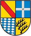
_COA.svg.png) Coat of arms | |
Location of Forst within Karlsruhe district 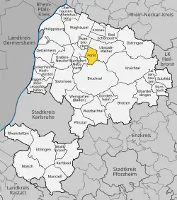 | |
 Forst  Forst | |
| Coordinates: 49°09′12″N 08°35′03″E / 49.15333°N 8.58417°E | |
| Country | Germany |
| State | Baden-Württemberg |
| Admin. region | Karlsruhe |
| District | Karlsruhe |
| Government | |
| • Mayor (2017–25) | Bernd Killinger[1] |
| Area | |
• Total | 11.47 km2 (4.43 sq mi) |
| Elevation | 112 m (367 ft) |
| Population (2023-12-31)[2] | |
• Total | 8,127 |
| • Density | 710/km2 (1,800/sq mi) |
| Time zone | UTC+01:00 (CET) |
| • Summer (DST) | UTC+02:00 (CEST) |
| Postal codes | 76694 |
| Dialling codes | 07251 |
| Vehicle registration | KA |
| Website | www.forst-baden.de |
Forst (German pronunciation: [fɔʁst] ⓘ) is a municipality in the district of Karlsruhe in Baden-Württemberg, Germany. It is located on Bertha Benz Memorial Route 2 km north of Bruchsal and shares a direct border with that city.
1988 F-16C jet fighter crash
On March 31, 1988, a US Air Force F-16C jet fighter crashed into the town during a low-altitude exercise. After striking the roof of a house and badly damaging another, the aircraft slid down along the length of Forster Hardtstrasse, setting several houses on fire. The pilot, 24-year old Lt. Thomas Edward Doyle, and a resident, 62-year old Theo Huber, were killed.[3][4]
References
- ^ Aktuelle Wahlergebnisse, Staatsanzeiger, accessed 13 September 2021.
- ^ "Bevölkerung nach Nationalität und Geschlecht am 31. Dezember 2023 (Fortschreibung auf Basis des Zensus 2022)" [Population by nationality and sex as of December 31, 2023 (updated based on the 2022 census)] (CSV) (in German). Statistisches Landesamt Baden-Württemberg.
- ^ "Fighter Jet Crashes, Explodes in Town Center; 2 Dead". AP News. April 1, 1988. Retrieved June 29, 2021.
- ^ Rolf Schmitt (March 31, 2013). "Eine Schneise der Verwüstung" [A Swath of Desolation] (in German). Bruchsal.org. Archived from the original on 2015-10-30. Retrieved June 29, 2021.