Flossach
| Flossach | |
|---|---|
 | |
| Location | |
| Country | Germany |
| State | Bavaria |
| Physical characteristics | |
| Source | |
| • location | northwest of Türkheim, east of Gerum (Rammingen) |
| • coordinates | 48°4′40″N 10°36′19″E / 48.07778°N 10.60528°E |
| • elevation | 588 m (1,929 ft) above sea level |
| Mouth | |
• location | north of Hasberg in the Mindel |
• coordinates | 48°12′36″N 10°26′31″E / 48.21000°N 10.44194°E |
• elevation | 522 m (1,713 ft) above sea level |
| Length | 21.9 km (13.6 mi)[1] |
| Basin features | |
| Progression | Mindel→ Danube→ Black Sea |
| Tributaries | |
| • left | Wörthbach, Tiefenbach, Hierbach |
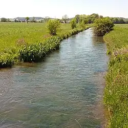
Flossach is a 21.9-kilometre-long (13.6 mi) river in Bavaria, Germany. It is a right tributary of the Mindel and an indirect right tributary of the Danube.
Geography
The Flossach rises near the village of Gerum, northwest of Türkheim at an elevation of 588 m (1,929 ft). It flows in a northwesterly direction through a broad valley, formed during the last glacial times. The 14.5 km (9.0 mi) long Weissbach flows parallel to the Flossach in the same valley. Approximately 900 m (3,000 ft) below the mouth of the brook Wörth, the Flossach divides into two branches. The main Flossach branch flows through the towns of Tussenhausen and Zaisertshofen; the other branch (called the Lettenbach or Lehnbachof) flows through Mattsiesmühle (north of Mattsies) and along the Mindelheim-Mattsies airfield. Just before joining the Mindel at an elevation of 522 m (1,713 ft), the Flossbach flows through the district of Günzburg and forms the border between Unterallgäu and Günzburg counties.
Places in the Flossach Valley
- Gerum (Rammingen )
- Mattsies and Mattsiesmühle (Tussenhausen )
- Tussenhausen
- Zaisertshofen (Tussenhausen )
Towns along the Flossach
- Salgen (located on the Eastern Mindel)
- Mörgen (Eppishausen)
- Bronnen (Salgen, located on the Eastern Mindel)
- Spöck (Kirchheim in Schwaben)
- Bronnerlehe (Salgen, located on the Eastern Mindel)
- Diepenhofen (Kirchheim in Schwaben)
- Kirchheim in Schwaben
- Dern (Kirchheim in Schwaben)
- Hasberg (Kirchheim in Schwaben, located on the Mindel)
See also
References
- ^ Complete table of the Bavarian Waterbody Register by the Bavarian State Office for the Environment (xls, 10.3 MB)