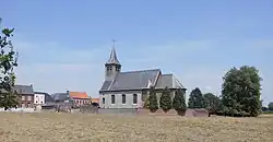
Spiere-Helkijn
Spiere-Helkijn | |
|---|---|
 Helkijn | |
 Flag  Coat of arms | |
Location of Spiere-Helkijn | |
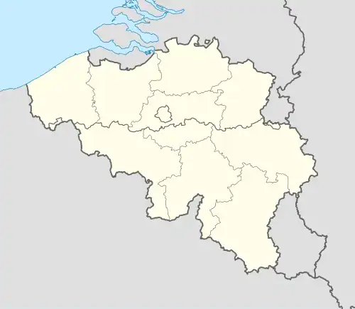 Spiere-Helkijn Location in Belgium
Location of Spiere-Helkijn in West-Flanders 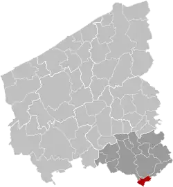 | |
| Coordinates: 50°43′N 03°21′E / 50.717°N 3.350°E | |
| Country | Belgium |
| Community | Flemish Community |
| Region | Flemish Region |
| Province | |
| Arrondissement | Kortrijk |
| Government | |
| • Mayor | Dirk Walraet (LB 2018) |
| • Governing party/ies | LB 2018 |
| Area | |
• Total | 10.82 km2 (4.18 sq mi) |
| Population (2018-01-01)[1] | |
• Total | 2,087 |
| • Density | 190/km2 (500/sq mi) |
| Postal codes | 8587 |
| NIS code | 34043 |
| Area codes | 056 |
| Website | www.spiere-helkijn.be |
Spiere-Helkijn (Dutch pronunciation: [ˌspiːrə ˈɦɛlkɛin] ⓘ; French: Espierres-Helchin, French pronunciation: [ɛspjɛʁ ɛlʃɛ̃]; West Flemish: Spiere-Elkyng) is a municipality located in the Belgian province of West Flanders. The municipality comprises the towns of Helkijn and Spiere. On January 1, 2018, Spiere-Helkijn had a total population of 2,087. The total area is 10.78 km2 which gives a population density of 194 inhabitants per km2.
References
- ^ "Wettelijke Bevolking per gemeente op 1 januari 2018". Statbel. Retrieved 9 March 2019.
External links
 Media related to Spiere-Helkijn at Wikimedia Commons
- Official website - Available only in Dutch
Places adjacent to Spiere-Helkijn | |
|---|---|
| Bruges | 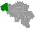 | |
|---|---|---|
| Diksmuide | ||
| Kortrijk | ||
| Ostend | ||
| Roeselare | ||
| Tielt | ||
| Veurne | ||
| Ypres | ||
| ||