Erbendorf
Erbendorf | |
|---|---|
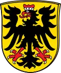 Coat of arms | |
Location of Erbendorf within Tirschenreuth district 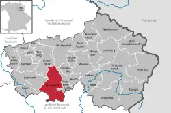 | |
 Erbendorf 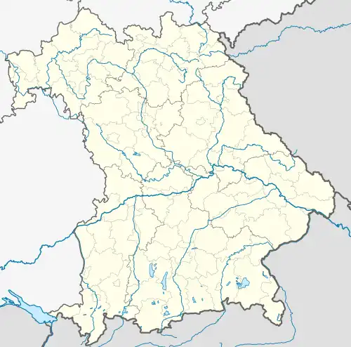 Erbendorf | |
| Coordinates: 49°50′N 12°3′E / 49.833°N 12.050°E | |
| Country | Germany |
| State | Bavaria |
| Admin. region | Oberpfalz |
| District | Tirschenreuth |
| Subdivisions | 23 Ortsteile |
| Government | |
| • Mayor (2020–26) | Johannes Reger[1] (CSU) |
| Area | |
• Total | 67.56 km2 (26.09 sq mi) |
| Elevation | 506 m (1,660 ft) |
| Population (2024-12-31)[2] | |
• Total | 5,095 |
| • Density | 75/km2 (200/sq mi) |
| Time zone | UTC+01:00 (CET) |
| • Summer (DST) | UTC+02:00 (CEST) |
| Postal codes | 92681 |
| Dialling codes | 09682 |
| Vehicle registration | TIR |
| Website | www.erbendorf.de |
Erbendorf (German pronunciation: [ˈɛʁbn̩ˌdɔʁf] ⓘ; Bavarian: Arndorf) is a town in the Upper Palatinate (Oberpfalz) region of Germany. As of December, 2006, the town has a population of 5,341.
The following villages are incorporated into the town: Aschenhof, Birkenreuth, Boxdorf, Eppenhof, Frodersreuth, Glashütte, Gössenreuth, Gramlhof, Grötschenreuth, Hauxdorf, Inglashof, Napfberg, Neuenreuth, Pfaben, Plärn, Schadenreuth, Siegritz, Steinbach, Straßenschacht, Thann, Wäldern, Wetzldorf, and Wildenreuth.
Main Attractions of Erbendorf
- Hiking and biking in the Stienwald region; a mountain range and a national park well known for its long-distance trails.
- The Mining Museum of Erbendorf, as the city has a very rich mining history.
- A public recreation center equipped with two heated outdoor pools.
- Walking tour of cellars.
Personalities
Sons and daughters of the city
- Hans Müller (1898-1974), politician (SPD), Member of Bundestag 1953-1965
- Wilhelm Schraml (born 1935), 84. Bishop of Passau
Personalities who have worked in the city
- Norbert Scharf (1952-2010), Landtag deputy (SPD), was from 2005 to 2008 member of the town council of Erbendorf
References
- ^ Liste der ersten Bürgermeister/Oberbürgermeister in kreisangehörigen Gemeinden, Bayerisches Landesamt für Statistik, 15 July 2021.
- ^ "Gemeinden, Kreise und Regierungsbezirke in Bayern, Einwohnerzahlen am 31. Dezember 2024; Basis Zensus 2022" [Municipalities, counties, and administrative districts in Bavaria; Based on the 2022 Census] (CSV) (in German). Bayerisches Landesamt für Statistik.
External links
Towns and municipalities in Tirschenreuth (district) | ||
|---|---|---|