Emerald Bay, Texas
Emerald Bay, Texas | |
|---|---|
 Emerald Bay, Texas | |
| Coordinates: 32°09′37″N 95°26′17″W / 32.16028°N 95.43806°W | |
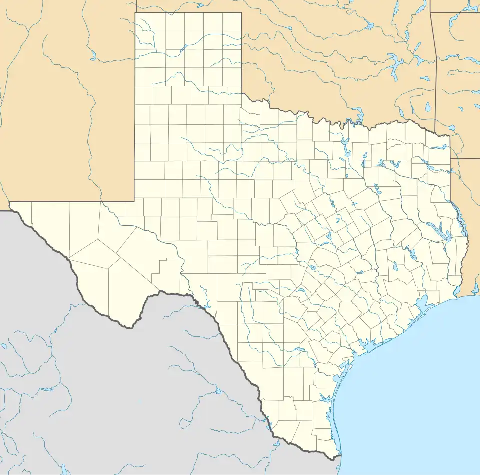
| Country | United States |
| State | Texas |
| County | Smith |
| Area | |
• Total | 1.5 sq mi (4 km2) |
| • Land | 0.75 sq mi (1.9 km2) |
| • Water | 0.75 sq mi (1.9 km2) |
| Elevation | 361 ft (110 m) |
| Population (2020) | |
• Total | 1,146 |
| • Density | 760/sq mi (290/km2) |
| Time zone | UTC-6 (Central (CST)) |
| • Summer (DST) | UTC-5 (CDT) |
| Zip Code | 75757 |
| Area codes | 430, 903 |
| GNIS feature ID | 2586927[1] |
Emerald Bay is a census-designated place (CDP) in Smith County, Texas, United States. It is located on the eastern side of Lake Palestine, near Bullard.[2] It is a census-designated place (CDP) created for the 2010 census. Emerald Bay had a population of 1,146 as of the 2020 census.
Demographics
| Census | Pop. | Note | %± |
|---|---|---|---|
| 2010 | 1,047 | — | |
| 2020 | 1,146 | 9.5% | |
| U.S. Decennial Census[3] 1850–1900[4] 1910[5] 1920[6] 1930[7] 1940[8] 1950[9] 1960[10] 1970[11] 1980[12] 1990[13] 2000[14] 2010[15] 2020[16] | |||
Emerald Bay first appeared as a census designated place in the 2010 U.S. Census.[15]
2020 census
| Race / Ethnicity (NH = Non-Hispanic) | Pop 2010[17] | Pop 2020[16] | % 2010 | % 2020 |
|---|---|---|---|---|
| White alone (NH) | 1,023 | 1,082 | 97.71% | 94.42% |
| Black or African American alone (NH) | 3 | 9 | 0.29% | 0.79% |
| Native American or Alaska Native alone (NH) | 2 | 5 | 0.19% | 0.44% |
| Asian alone (NH) | 11 | 12 | 1.05% | 1.05% |
| Pacific Islander alone (NH) | 0 | 0 | 0.00% | 0.00% |
| Other race alone (NH) | 0 | 0 | 0.00% | 0.00% |
| Mixed race or Multiracial (NH) | 2 | 24 | 0.19% | 2.09% |
| Hispanic or Latino (any race) | 6 | 14 | 0.57% | 1.22% |
| Total | 1,047 | 1,146 | 100.00% | 100.00% |
As of the 2020 United States census, there were 1,146 people, 442 households, and 361 families residing in the CDP.
See also
Notes
References
- ^ a b U.S. Geological Survey Geographic Names Information System: Emerald Bay, Texas
- ^ "Emerald Bay, Texas :: Boundary Map of Emerald Bay, Texas". Archived from the original on December 20, 2016.
- ^ "Decennial Census by Decade". United States Census Bureau.
- ^ "1900 Census of Population - Population of Texas By Counties And Minor Civil Divisions" (PDF). United States Census Bureau.
- ^ "1910 Census of Population - Supplement for Texas" (PDF). United States Census Bureau.
- ^ "1920 Census of Population - Number of Inhabitants - Texas" (PDF). United States Census Bureau.
- ^ "1930 Census of Population - Number of Inhabitants - Texas" (PDF). United States Census Bureau.
- ^ "1940 Census of Population - Number of Inhabitants - Texas" (PDF). United States Census Bureau.
- ^ "1950 Census of Population - Number of Inhabitants - Texas" (PDF). United States Census Bureau.
- ^ "1960 Census of Population - Number of Inhabitants - Texas" (PDF). United States Census Bureau.
- ^ "1970 Census of Population - Number of Inhabitants - Texas" (PDF). United States Census Bureau.
- ^ "1980 Census of Population - Number of Inhabitants - Texas" (PDF). United States Census Bureau.
- ^ "1990 Census of Population - Population and Housing Unit Counts - Texas" (PDF). United States Census Bureau.
- ^ "2000 Census of Population - Population and Housing Unit Counts - Texas" (PDF). United States Census Bureau.
- ^ a b "2010 Census of Population - Population and Housing Unit Counts - Texas" (PDF). United States Census Bureau.
- ^ a b "P2 Hispanic or Latino, and Not Hispanic or Latino by Race – 2020: DEC Redistricting Data (PL 94-171) – Emerald Bay CDP, Texas". United States Census Bureau.
- ^ "P2 Hispanic or Latino, and Not Hispanic or Latino by Race – 2010: DEC Redistricting Data (PL 94-171) – Emerald Bay CDP, Texas". United States Census Bureau.
External links
![]() Media related to Emerald Bay, Texas at Wikimedia Commons
Media related to Emerald Bay, Texas at Wikimedia Commons
Municipalities and communities of Smith County, Texas, United States | ||
|---|---|---|
| Cities | 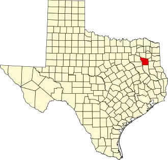 | |
| Towns | ||
| CDP | ||
| Other unincorporated communities |
| |
| Ghost towns | ||
| Footnotes | ‡This populated place also has portions in an adjacent county or counties | |