Emamzadeh Jafar, Kohgiluyeh and Boyer-Ahmad
Emamzadeh Jafar
Persian: امامزاده جعفر | |
|---|---|
Village | |
 Emamzadeh Jafar | |
| Coordinates: 30°18′39″N 50°58′23″E / 30.31083°N 50.97306°E[1] | |
| Country | Iran |
| Province | Kohgiluyeh and Boyer-Ahmad |
| County | Gachsaran |
| District | Central |
| Rural District | Emamzadeh Jafar |
| Population (2016)[2] | |
• Total | 502 |
| Time zone | UTC+3:30 (IRST) |
Emamzadeh Jafar (Persian: امامزاده جعفر)[a] is a village in, and the capital of, Emamzadeh Jafar Rural District of the Central District of Gachsaran County, Kohgiluyeh and Boyer-Ahmad province, Iran.[4]
Demographics
Population
At the time of the 2006 National Census, the village's population was 1,890 in 382 households.[5] The following census in 2011 counted 401 people in 88 households.[6] The 2016 census measured the population of the village as 502 people in 144 households.[2]
See also
Notes
References
- ^ OpenStreetMap contributors (26 December 2024). "Emamzadeh Jafar, Gachsaran County" (Map). OpenStreetMap (in Persian). Retrieved 26 December 2024.
- ^ a b Census of the Islamic Republic of Iran, 1395 (2016): Kohgiluyeh and Boyer-Ahmad Province. amar.org.ir (Report) (in Persian). The Statistical Center of Iran. Archived from the original (Excel) on 2 November 2021. Retrieved 19 December 2022.
- ^ Emamzadeh Jafar can be found at GEOnet Names Server, at this link, by opening the Advanced Search box, entering "-3062068" in the "Unique Feature Id" form, and clicking on "Search Database".
- ^ Mousavi, Mirhossein (19 December 1390) [Approved 2 February 1366]. Creation and establishment of six rural districts including villages, farms and places in Gachsaran County under Kohgiluyeh and Boyer-Ahmad province. rc.majlis.ir (Report) (in Persian). Ministry of the Interior, Council of Ministers. Proposal 5.53.1.7682; Notification 122134/T721. Archived from the original on 8 March 2012. Retrieved 24 January 2024 – via Islamic Parliament Research Center.
- ^ Census of the Islamic Republic of Iran, 1385 (2006): Kohgiluyeh and Boyer-Ahmad Province. amar.org.ir (Report) (in Persian). The Statistical Center of Iran. Archived from the original (Excel) on 20 September 2011. Retrieved 25 September 2022.
- ^ Census of the Islamic Republic of Iran, 1390 (2011): Kohgiluyeh and Boyer-Ahmad Province. irandataportal.syr.edu (Report) (in Persian). The Statistical Center of Iran. Archived from the original (Excel) on 19 January 2023. Retrieved 19 December 2022 – via Iran Data Portal, Syracuse University.
| Capital | 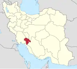 | ||||||||||||||||||
|---|---|---|---|---|---|---|---|---|---|---|---|---|---|---|---|---|---|---|---|
| Counties and cities |
| ||||||||||||||||||
| Sights |
| ||||||||||||||||||
| populated places | |||||||||||||||||||