Drury, Kansas
Drury, Kansas | |
|---|---|
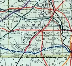 1915 Railroad Map of Sumner County | |
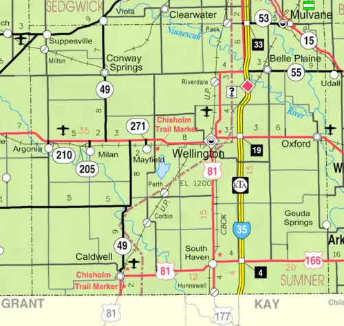 KDOT map of Sumner County (legend) | |
 Drury  Drury | |
| Coordinates: 37°02′08″N 97°28′40″W / 37.03556°N 97.47778°W[1] | |
| Country | United States |
| State | Kansas |
| County | Sumner |
| Township | Falls |
| Elevation | 1,093 ft (333 m) |
| Time zone | UTC-6 (CST) |
| • Summer (DST) | UTC-5 (CDT) |
| Area code | 620 |
| FIPS code | 20-18725 |
| GNIS ID | 470077 [1] |
Drury is an unincorporated community in Falls Township, Sumner County, Kansas, United States.[1] It is located between South Haven and Caldwell near the intersection of S Drury Rd and W 175th St S, next to the Chikaskia River and next to an abandoned railroad.
History
Drury was a station and shipping point on the Kansas Southwestern Railway that previously passed through the community, east to west, from South Haven to Caldwell.[2]
Drury had a post office from 1884 until 1921.[3]
The movie Americana was filmed in Drury.
Education
The community is served by Caldwell USD 360 public school district.
References
- ^ a b c d "Drury, Kansas", Geographic Names Information System, United States Geological Survey, United States Department of the Interior
- ^ Blackmar, Frank Wilson (1912). Kansas: A Cyclopedia of State History, Embracing Events, Institutions, Industries, Counties, Cities, Towns, Prominent Persons, Etc. Standard Publishing Company. pp. 549.
- ^ "Kansas Post Offices, 1828-1961". Kansas Historical Society. Archived from the original on October 9, 2013. Retrieved June 27, 2014.
Further reading
External links
- Sumner County website
- Drury Dam in south Sumner County had one colorful history - Sumner News
- Drury Dam Waterfall - Kansas Travel
- Historic Images of Drury - Special Photo Collections at Wichita State University Library
Municipalities and communities of Sumner County, Kansas, United States | ||
|---|---|---|
| Cities | 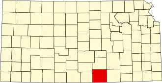 | |
| CDPs | ||
| Unincorporated communities | ||
| Ghost towns | ||
| Townships |
| |
| Footnotes | ‡This community also has portions in an adjacent county or counties. | |