Schloen-Dratow
Schloen-Dratow | |
|---|---|
Location of Schloen-Dratow within Mecklenburgische Seenplatte district 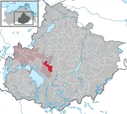 | |
 Schloen-Dratow 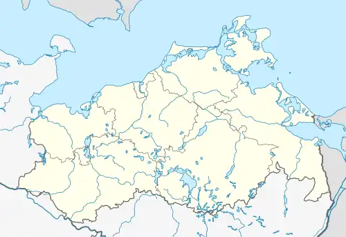 Schloen-Dratow | |
| Coordinates: 53°31′N 12°49′E / 53.517°N 12.817°E | |
| Country | Germany |
| State | Mecklenburg-Vorpommern |
| District | Mecklenburgische Seenplatte |
| Municipal assoc. | Seenlandschaft Waren |
| Area | |
• Total | 36.12 km2 (13.95 sq mi) |
| Elevation | 62 m (203 ft) |
| Population (2023-12-31)[1] | |
• Total | 825 |
| • Density | 23/km2 (59/sq mi) |
| Time zone | UTC+01:00 (CET) |
| • Summer (DST) | UTC+02:00 (CEST) |
| Postal codes | 17192, 17219 |
| Dialling codes | 039934 |
| Vehicle registration | MÜR |
Schloen-Dratow (before January 2014: Dratow-Schloen) is a municipality in the Mecklenburgische Seenplatte district, Mecklenburg-Vorpommern, Germany. It was formed on 1 January 2012 by the merger of the former municipalities Groß Dratow and Schloen.
References