Courcelles-le-Roi
Courcelles-le-Roi | |
|---|---|
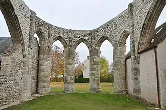 The unfinished choir of the church in Courcelles | |
.svg.png) Coat of arms | |
Location of Courcelles-le-Roi | |
 Courcelles-le-Roi 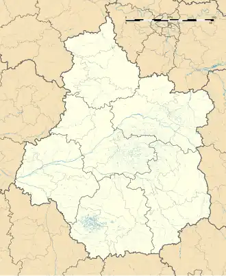 Courcelles-le-Roi | |
| Coordinates: 48°05′46″N 2°19′08″E / 48.0961°N 2.3189°E | |
| Country | France |
| Region | Centre-Val de Loire |
| Department | Loiret |
| Arrondissement | Pithiviers |
| Canton | Le Malesherbois |
| Intercommunality | Pithiverais-Gâtinais |
| Government | |
| • Mayor (2020–2026) | Jonathan Wera[1] |
Area 1 | 6.3 km2 (2.4 sq mi) |
| Population (2022)[2] | 318 |
| • Density | 50/km2 (130/sq mi) |
| Demonym | Courcellois |
| Time zone | UTC+01:00 (CET) |
| • Summer (DST) | UTC+02:00 (CEST) |
| INSEE/Postal code | 45110 / |
| Elevation | 97–118 m (318–387 ft) |
| 1 French Land Register data, which excludes lakes, ponds, glaciers > 1 km2 (0.386 sq mi or 247 acres) and river estuaries. | |
Courcelles-le-Roi (French pronunciation: [kuʁsɛl lə ʁwa]; before 2018: Courcelles)[3] is a commune in the Loiret department in north-central France.
See also
References
- ^ "Répertoire national des élus: les maires" (in French). data.gouv.fr, Plateforme ouverte des données publiques françaises. 13 September 2022.
- ^ "Populations de référence 2022" (in French). The National Institute of Statistics and Economic Studies. 19 December 2024.
- ^ Décret n° 2018-956 5 November 2018 (in French)
Wikimedia Commons has media related to Courcelles-le-Roi.