Chippubetsu, Hokkaido
Chippubetsu 
    秩父別町  | |
|---|---|
Town  | |
Chippubetsu town hall  | |
![]() Flag ![]() Emblem  | |
![]() Location of Chippubetsu in Hokkaido (Sorachi Subprefecture)  | |
![]() Chippubetsu Location in Japan  | |
| Coordinates: 43°46′N 141°57′E / 43.767°N 141.950°E | |
| Country | Japan | 
| Region | Hokkaido | 
| Prefecture | Hokkaido (Sorachi Subprefecture) | 
| District | Uryū | 
| Area | |
 • Total  | 47.26 km2 (18.25 sq mi) | 
| Population  (October 1, 2020)  | |
 • Total  | 2,329 | 
| • Density | 49/km2 (130/sq mi) | 
| Time zone | UTC+09:00 (JST) | 
| Website | www | 
Chippubetsu (秩父別町, Chippubetsu-chō) is a town located in Sorachi Subprefecture, Hokkaido, Japan.
Demographics
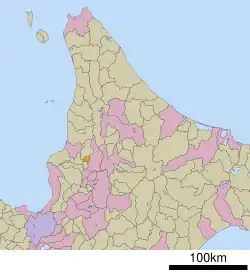
Per Japanese census data,[1] the population of Chippubetsu has declined by roughly 50 percent over the past half-century.
| Year | Pop. | ±% | 
|---|---|---|
| 1970 | 5,036 | — | 
| 1980 | 4,193 | −16.7% | 
| 1990 | 3,735 | −10.9% | 
| 2000 | 3,268 | −12.5% | 
| 2010 | 2,730 | −16.5% | 
| 2020 | 2,329 | −14.7% | 
Culture
Mascot

Chippubetsu's mascot is Chibel-kun (チーベルくん, Chīberu-kun). He is a scarecrow with a cape. He usually attends not only events held in Chippubetsu but events outside of the town. His hat can tell time.[2]
References
- ^ "Chippubetsu (Hokkaidō , Japan) - Population Statistics, Charts, Map, Location, Weather and Web Information". Retrieved 6 March 2025.
 - ^ "チーベルくんのプロフィール(秩父別町)". Kawaii Hokkaido.
 
External links
 Media related to Chippubetsu, Hokkaidō at Wikimedia Commons- Official Website (in Japanese)


