Château-Larcher
Château-Larcher | |
|---|---|
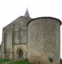 The church in Château-Larcher | |
Location of Château-Larcher | |
 Château-Larcher  Château-Larcher | |
| Coordinates: 46°25′06″N 0°18′55″E / 46.4183°N 0.3153°E | |
| Country | France |
| Region | Nouvelle-Aquitaine |
| Department | Vienne |
| Arrondissement | Poitiers |
| Canton | Vivonne |
| Government | |
| • Mayor (2020–2026) | Francis Gargouil[1] |
Area 1 | 15.35 km2 (5.93 sq mi) |
| Population (2022)[2] | 1,046 |
| • Density | 68/km2 (180/sq mi) |
| Time zone | UTC+01:00 (CET) |
| • Summer (DST) | UTC+02:00 (CEST) |
| INSEE/Postal code | 86065 /86370 |
| Elevation | 85–135 m (279–443 ft) (avg. 95 m or 312 ft) |
| 1 French Land Register data, which excludes lakes, ponds, glaciers > 1 km2 (0.386 sq mi or 247 acres) and river estuaries. | |
Château-Larcher (French pronunciation: [ʃɑto laʁʃe]; Poitevin: Chât'lachèr / Chatelarchér) is a commune in the Vienne department in the Nouvelle-Aquitaine region in western France.
Geography
The Clouère flows northwestward through the middle of the commune, forms part of its north-eastern border, then flows into the Clain, which forms its north-western border.
See also
References
- ^ "Répertoire national des élus: les maires". data.gouv.fr, Plateforme ouverte des données publiques françaises (in French). 2 December 2020.
- ^ "Populations de référence 2022" (in French). The National Institute of Statistics and Economic Studies. 19 December 2024.
Wikimedia Commons has media related to Château-Larcher.