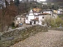
Cangas del Narcea
Cangas del Narcea | |
|---|---|
 View of Cangas del Narcea | |
 Coat of arms | |
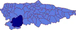 | |
 Cangas del Narcea Location in Spain | |
| Coordinates: 43°10′17″N 6°32′20″W / 43.17139°N 6.53889°W | |
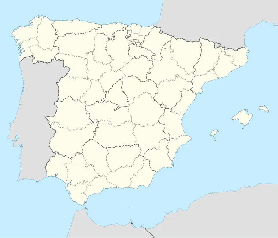
| Country | |
| Autonomous community | |
| Province | Asturias |
| Comarca | Narcea |
| Judicial district | Cangas del Narcea |
| Capital | Cangas del Narcea |
| Government | |
| • Alcalde | José Luis Fontaniella (PP) |
| Area | |
• Total | 823.57 km2 (317.98 sq mi) |
| Highest elevation | 2,007 m (6,585 ft) |
| Population (2024)[1] | |
• Total | 11,421 |
| • Density | 14/km2 (36/sq mi) |
| Demonym | cangués / canguesa |
| Time zone | UTC+1 (CET) |
| • Summer (DST) | UTC+2 (CEST) |
| Postal code | 33800-33819 |
| Website | Official website |

Cangas del Narcea is the oldest municipality in the Principality of Asturias in Spain. It is also the largest municipality in Asturias.[2]
It is in the southwest of Asturias, on the Asturian border with León. Until 1927, Cangas del Narcea was known as Cangas de Tineo (Asturian: Cangas de Tinéu).[3]
Cangas del Narcea is also the name of the municipality's capital, and one of the judicial districts in Asturias.[4]
Geography
Parishes
Cangas del Narcea is divided into 54 parishes:[5]
|
Protected areas
Muniellos Wood, a nature reserve which lies within Cangas del Narcea and Ibias, is the core area of the Muniellos Biosphere Reserve (designated by UNESCO in 2000 and later extended). In 2002 a new natural park was created, the Natural Park of Fuentes del Narcea, Degaña, and Ibias (Parque Natural de Fuentes del Narcea, Degaña e Ibias), an area of 550 km2 (212 sq mi). The natural park provides the core area of the biosphere reserve with a buffer zone.[6] The park's formation prompted legal action by landowners, but a management plan for the protected area was approved in 2006.
The Muniellos Visitor Centre is in Cangas del Narcea.[7]
Politics
| PSOE | PP | PCE/IU-BA | UCD/CDS | URAS | UCA | Others | Total | |
|---|---|---|---|---|---|---|---|---|
| 1979 | 1 | 3 | 2 | 9 | - | 5 | 1 | 21 |
| 1983 | 7 | 5 | 6 | - | - | - | 3 | 21 |
| 1987 | 10 | 3 | 3 | 5 | - | - | 0 | 21 |
| 1991 | 11 | 6 | 3 | 0 | - | - | 1 | 21 |
| 1995 | 8 | 6 | 2 | 0 | - | - | 1 | 17 |
| 1999 | 9 | 5 | 1 | - | 1 | - | 1 | 17 |
| 2003 | 7 | 7 | 2 | - | 1 | - | 0 | 17 |
| 2007 | 8 | 6 | 3 | - | 0 | - | 0 | 17 |
| 2011 | 4 | 5 | 6 | - | 0 | - | 1 | 17 |
Demography
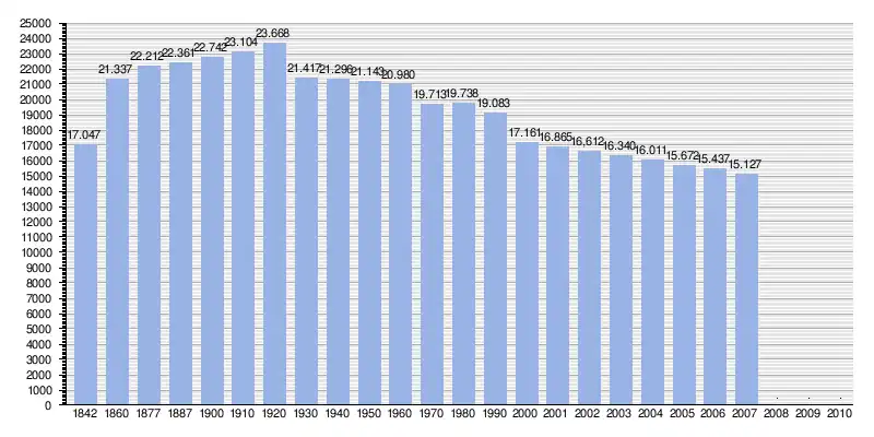 |
by: Instituto Nacional de Estadística de España - graphic for Wikipedia
|
See also
References
- ^ Municipal Register of Spain 2018. National Statistics Institute.
- ^ "Cangas del Narcea – FACC". www.facc.info. Retrieved 2025-04-11.
- ^ "Archivos de Asturias - Gobierno del Principado de Asturias". archivosdeasturias.info. Retrieved 2025-04-11.
- ^ "BOE-A-1989-11182 Ley 1/1989, de 18 de abril, por la que se determina la capitalidad de los partidos judiciales comprendidos en el ámbito territorial del Principado de Asturias". www.boe.es. Retrieved 2025-04-11.
- ^ "Parroquias y pueblos - Ayuntamiento de Cangas del Narcea". www.ayto-cnarcea.es. Retrieved 2025-04-11.
- ^ "Biosphere Reserve Directory". UNESCO. 2007. Retrieved 13 July 2016.
- ^ "Muniellos visitor centre". Groundspeak. Retrieved 15 July 2016.