Calcott, Shropshire
| Calcott | |
|---|---|
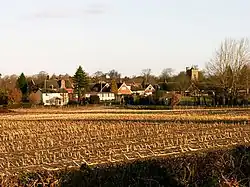 Farmland at Calcott | |
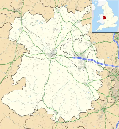 Calcott Location within Shropshire | |
| OS grid reference | SJ449139 |
| Civil parish | |
| Unitary authority | |
| Ceremonial county | |
| Region | |
| Country | England |
| Sovereign state | United Kingdom |
| Post town | SHREWSBURY |
| Postcode district | SY3 |
| Dialling code | 01743 |
| Police | West Mercia |
| Fire | Shropshire |
| Ambulance | West Midlands |
| UK Parliament | |
Calcott is a hamlet in Shropshire, England.[1] It falls within the civil parish of Bicton.[2] The name derives from the Old English calde cote, meaning cold huts, or cold cots.[3]
References
- ^ "Calcott, Shropshire - area information, map, walks and more". getoutside.ordnancesurvey.co.uk. Retrieved 1 February 2024.
- ^ "Election Maps Bicton Parish". ordnancesurvey.co.uk. Retrieved 1 February 2024.
On the left of the screen is the "Boundary" tab; click this and activate either civil parishes or Westminster Constituencies (or both), however, only two functions can be active at any one time.
- ^ Ekwall, Eilert (1960). The concise Oxford dictionary of English place-names (4 ed.). Oxford: Oxford University Press. p. 82. ISBN 0-19-869103-3.
{{cite book}}: ISBN / Date incompatibility (help)
Wikimedia Commons has media related to Calcott, Shropshire.