Brook Forest, Colorado
Brook Forest, Colorado | |
|---|---|
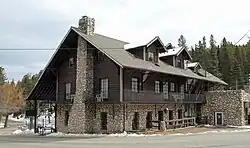 Brook Forest Inn. | |
 Brook Forest Location of Brook Forest, Colorado.  Brook Forest Brook Forest (Colorado) | |
| Coordinates: 39°34′46″N 105°22′55″W / 39.5794°N 105.3819°W[2] | |
| Country | United States |
| State | Colorado |
| County | Jefferson and Clear Creek[1] |
| Government | |
| • Type | unincorporated community |
| • Body | Jefferson & Clear Creek counties[1] |
| Area | |
• Total | 1.389 sq mi (3.597 km2) |
| • Land | 1.389 sq mi (3.597 km2) |
| • Water | 0.000 sq mi (0.000 km2) |
| Elevation | 8,035 ft (2,449 m) |
| Population | |
• Total | 622 |
| • Density | 450/sq mi (170/km2) |
| Time zone | UTC−07:00 (MST) |
| • Summer (DST) | UTC−06:00 (MDT) |
| ZIP code[5] | Evergreen 80439 |
| Area codes | 303/720/983 |
| GNIS pop ID | 182521 |
| GNIS town ID | 2804446 |
| FIPS code | 08-08950 |
Brook Forest is an unincorporated community and a census-designated place (CDP) located in Jefferson and Clear Creek counties, Colorado, United States. The population was 622 at the 2020 census.[4] The CDP is a part of the Denver–Aurora–Lakewood, CO Metropolitan Statistical Area.
History
The Brook Forest, Colorado, post office operated from October 11, 1921, until Feb 15, 1949.[6] The Evergreen Post Office (ZIP Code 80439) now serves the area.[5]
Geography
Brook Forest is located at coordinates 39°34′46″N 105°22′55″W / 39.5794°N 105.3819°W at an elevation of 8,035 feet (2,449 m).[2]
At the 2020 United States Census, the Brook Forest CDP had an area of 889 acres (3.597 km2), all land.[3]
Demographics
The United States Census Bureau defined the Brook Forest CDP for the United States Census 2020.
| Year | Pop. | ±% |
|---|---|---|
| 2020 | 622 | — |
| Source: United States Census Bureau | ||
See also
- Denver-Aurora-Lakewood, CO Metropolitan Statistical Area
- Front Range Urban Corridor
- List of census-designated places in Colorado
- List of populated places in Colorado
- List of post offices in Colorado
References
- ^ a b "Colorado Counties". Colorado Department of Local Affairs. Retrieved February 2, 2025.
- ^ a b c "Brook Forest, Colorado". Geographic Names Information System. United States Geological Survey, United States Department of the Interior. Retrieved February 2, 2025.
- ^ a b "State of Colorado Census Designated Places - BAS20 - Data as of January 1, 2020". United States Census Bureau. Retrieved December 10, 2020.
- ^ a b United States Census Bureau. "Brook Forest CDP, Colorado". Retrieved April 5, 2023.
- ^ a b "ZIP Code Lookup". United States Postal Service. Retrieved February 2, 2025.
- ^ Bauer, William H.; Ozment, James L.; Willard, John H. (1990). Colorado Post Offices 1859–1989. Golden, Colorado: Colorado Railroad Historical Foundation. ISBN 0-918654-42-4.
External links
- Jefferson County, Colorado
- Clear Creek County, Colorado
- State of Colorado
- Brook Forest Inn @ History Colorado
- Brook Forest Inn @ RockyMountainParanormal.com
- The Brook Forest Inn - Ghosts, Germans and Gold
Municipalities and communities of Jefferson County, Colorado, United States | ||
|---|---|---|
| Cities |  | |
| Towns | ||
| CDPs | ||
| Unincorporated communities | ||
| Ghost towns | ||
| Footnotes | ‡This populated place also has portions in an adjacent county or counties | |
Municipalities and communities of Clear Creek County, Colorado, United States | ||
|---|---|---|
| Cities | ||
| Towns | ||
| CDPs | ||
| Unincorporated communities | ||
| Ghost towns |
| |
| Footnotes | ‡This populated place also has portions in an adjacent county or counties | |