Bradáčov
Bradáčov | |
|---|---|
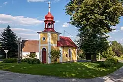 Chapel in the centre of Bradáčov | |
 Bradáčov Location in the Czech Republic | |
| Coordinates: 49°29′28″N 14°52′16″E / 49.49111°N 14.87111°E | |
| Country | |
| Region | South Bohemian |
| District | Tábor |
| First mentioned | 1378 |
| Area | |
• Total | 4.48 km2 (1.73 sq mi) |
| Elevation | 664 m (2,178 ft) |
| Population (2025-01-01)[1] | |
• Total | 45 |
| • Density | 10/km2 (26/sq mi) |
| Time zone | UTC+1 (CET) |
| • Summer (DST) | UTC+2 (CEST) |
| Postal code | 391 43 |
| Website | bradacov |
Bradáčov is a municipality and village in Tábor District in the South Bohemian Region of the Czech Republic. It has about 50 inhabitants.
Bradáčov lies approximately 18 kilometres (11 mi) north-east of Tábor, 65 km (40 mi) north-east of České Budějovice, and 74 km (46 mi) south-east of Prague.
Administrative division
Bradáčov consists of two municipal parts (in brackets population according to the 2021 census):[2]
- Bradáčov (29)
- Horní Světlá (13)
Demographics
| Year | Pop. | ±% |
|---|---|---|
| 1869 | 397 | — |
| 1880 | 425 | +7.1% |
| 1890 | 391 | −8.0% |
| 1900 | 414 | +5.9% |
| 1910 | 405 | −2.2% |
| 1921 | 346 | −14.6% |
| 1930 | 340 | −1.7% |
| 1950 | 225 | −33.8% |
| 1961 | 192 | −14.7% |
| 1970 | 197 | +2.6% |
| 1980 | 138 | −29.9% |
| 1991 | 94 | −31.9% |
| 2001 | 74 | −21.3% |
| 2011 | 55 | −25.7% |
| 2021 | 42 | −23.6% |
| Source: Censuses[3][4] | ||
References
- ^ "Population of Municipalities – 1 January 2025". Czech Statistical Office. 2025-05-16.
- ^ "Public Census 2021 – basic data". Public Database (in Czech). Czech Statistical Office. 2022.
- ^ "Historický lexikon obcí České republiky 1869–2011" (in Czech). Czech Statistical Office. 2015-12-21.
- ^ "Population Census 2021: Population by sex". Public Database. Czech Statistical Office. 2021-03-27.
External links
Wikimedia Commons has media related to Bradáčov.