Botija, Cáceres
Botija | |
|---|---|
municipality | |
.svg.png) Flag .svg.png) Coat of arms | |
 | |
| Coordinates: 39°20′43″N 6°04′23″W / 39.34528°N 6.07306°W | |
| Country | Spain |
| Autonomous community | Extremadura |
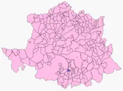
| Province | Cáceres |
| Municipality | Botija |
| Area | |
• Total | 193 km2 (75 sq mi) |
| Elevation | 411 m (1,348 ft) |
| Population (2018)[1] | |
• Total | 187 |
| Time zone | UTC+1 (CET) |
| • Summer (DST) | UTC+2 (CEST) |
| Website | http://www.botija.es/ |
Botija is a municipality located in the province of Cáceres, Extremadura, Spain. According to the 2013 census (INE), the municipality has a population of 193 inhabitants.[2]
See also
External links
References
- ^ Municipal Register of Spain 2018. National Statistics Institute.
- ^ Population in INE Archived 2009-01-15 at the Wayback Machine
Wikimedia Commons has media related to Botija (Cáceres).