Black Duck (also known as Black Duck Siding) is a local service district and designated place in the Canadian province of Newfoundland and Labrador that is 15 km (9 mi) east of the town of Stephenville. It is characterized by Harry's River, which runs past the community and is an Atlantic salmon fishing river.
Black Duck is known as the retirement place of Captain Victor Campbell RN, the Antarctic explorer who established a community of expats there in the 1920s.
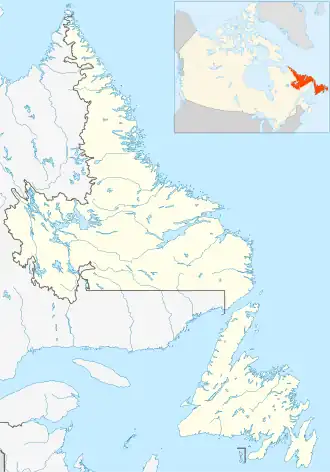
Geography
Black Duck is in Newfoundland and straddles the boundary Subdivision C and Subdivision D, both within Division No. 4.[1]
Demographics
As a designated place in the 2016 Census of Population conducted by Statistics Canada, Black Duck recorded a population of 110 living in 48 of its 60 total private dwellings, a change of 11.1% from its 2011 population of 99. With a land area of 19.75 km2 (7.63 sq mi), it had a population density of 5.6/km2 (14.4/sq mi) in 2016.[2]
Government
Black Duck is a local service district (LSD)of the Town of Stephenville Crossing.[3] that is governed by a committee responsible for the provision of certain services to the community.[4][3]
See also
References
- ^ "Population and dwelling counts, for Canada, provinces and territories, census divisions, census subdivisions (municipalities) and designated places, 2016 and 2011 censuses – 100% data (Newfoundland and Labrador)". Statistics Canada. February 7, 2018. Retrieved December 23, 2021.
- ^ "Population and dwelling counts, for Canada, provinces and territories, and designated places, 2016 and 2011 censuses – 100% data (Newfoundland and Labrador)". Statistics Canada. February 7, 2018. Retrieved December 22, 2021.
- ^ a b "Directory of Local Service Districts" (PDF). Government of Newfoundland and Labrador. October 2021. Retrieved January 1, 2022.
- ^ "Local Service Districts – Frequently Asked Questions". Government of Newfoundland and Labrador. Retrieved January 1, 2022.
|
|---|
| Towns | |
|---|
Unorganized
subdivisions | |
|---|
Designated
places | |
|---|
Unincorporated
communities | |
|---|
|
|
|---|
|
Subdivisions and
statistical units | |
|---|
| Communities | |
|---|
| Cities | |
|---|
Local service
districts (LSDs)
and designated
places (DPLs) | Both LSDs
and DPLs |
- Aspen Cove
- Barachois Brook
- Bartlett's Harbour
- Bay St. George South
- Beaches
- Bear Cove, Northern Peninsula
- Beau Bois
- Bellevue
- Bellevue Beach
- Benoits Siding
- Benton
- Birchy Cove
- Black Duck Brook and Winterhouse
- Black Duck Cove, Northern Peninsula
- Black Tickle
- Blaketown
- Boyd's Cove
- Bridgeport
- Brig Bay
- Brigus South
- Brown's Arm
- Buchans Junction
- Bunyan's Cove
- Burgoyne's Cove
- Burnside-St. Chads
- Burnt Cove, St. Michael's, Bauline South
- Burnt Point-Gull Island-Northern Bay
- Calvert
- Campbells Creek
- Canning's Cove
- Cape Freels North
- Cape Ray
- Caplin Cove-Southport
- Castor River North
- Castor River South
- Cavendish
- Chanceport
- Charlottetown, Bonavista Bay
- Cobb's Arm
- Cottrell's Cove
- Deadman's Bay
- Deep Bight
- Diamond Cove
- Dildo
- Dunfield
- Eddies Cove West
- Epworth-Great Salmonier
- Fairbanks-Hillgrade
- Fairhaven
- Flat Bay
- Forest Field-New Bridge
- Forresters Point
- Fox Island River-Point au Mal
- Fox Roost-Margaree
- Francois
- Freshwater, Conception Bay
- Gander Bay North
- Gander Bay South
- Garden Cove
- Georgetown
- Glovers Harbour
- Goobies
- Grates Cove
- Great Brehat
- Great Codroy
- Green Island Brook
- Green's Harbour
- Grey River
- Harbour Mille-Little Harbour East
- Harry's Harbour
- Herring Neck
- Hickman's Harbour-Robinson Bight
- Hodge's Cove
- Hopeall
- Horwood
- Indian Cove
- Jackson's Cove-Langdon's Cove-Silverdale
- Jean de Baie
- La Poile
- Lance Cove, Bell Island
- L'Anse aux Meadows to Quirpon
- Laurenceton
- Little Harbour (East), Placentia Bay
- Little Rapids
- Little St. Lawrence
- Lodge Bay
- Loon Bay
- Lower Lance Cove
- Main Point-Davidsville
- Mainland
- Makinsons
- Markland
- Marysvale
- Mattis Point
- McCallum
- Merritt's Harbour
- Mobile
- Moreton's Harbour
- Nameless Cove
- New Chelsea-New Melbourne-Brownsdale-Sibley's Cove-Lead Cove
- New Harbour, Trinity Bay
- Newman's Cove
- Newville
- Noggin Cove
- Norman's Bay
- Norris Arm North
- North Harbour, St. Mary's Bay
- O'Donnells
- Old Shop
- Open Hall-Red Cliffe
- O'Regan's Central
- Patrick's Cove-Angels Cove
- Pensons Arm
- Petit Forte
- Petley
- Phillips Head
- Piccadilly Head
- Piccadilly Slant-Abraham's Cove
- Pidgeon Cove-St. Barbe
- Pleasantview
- Plum Point
- Pollard's Point
- Port Albert
- Portland Creek
- Purcell's Harbour
- Pynns Brook
- Random Island West
- Random Sound West
- Rattling Brook
- Reefs Harbour-Shoal Cove West-New Ferolle
- Roaches Line
- Rock Harbour
- Searston
- Sheaves Cove
- Sheppardville
- Ship Cove, Northern Peninsula
- Ship Cove-Lower Cove-Jerry's Nose
- Smith's Harbour
- Smith's Sound
- Sop's Arm
- South Dildo
- South East Bight
- Spanish Room
- Spillars Cove
- St Andrews
- St. Anthony Bight
- St. Joseph's Cove-St. Veronica's
- St. Judes
- St Patricks
- St. Teresa
- Stanhope
- Stoneville
- Summerville-Princeton-Southern Bay
- Swift Current
- Thornlea
- Three Rock Cove
- Tizzard's Harbour
- Tompkins
- Tors Cove
- Upper Amherst Cove
- Upper Ferry
- Valley Pond
- Virgin Arm-Carter's Cove
- West Bay
- Wild Cove, White Bay
- William's Harbour
|
|---|
| LSDs only | |
|---|
| DPLs only | |
|---|
|
|---|
 Category:Newfoundland and Labrador Category:Newfoundland and Labrador Portal:Canada Portal:Canada WikiProject:Newfoundland and Labrador WikiProject:Newfoundland and Labrador
|
48°34′19″N 58°22′52″W / 48.572°N 58.381°W / 48.572; -58.381