Bednáreček
Bednáreček | |
|---|---|
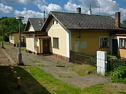 Train station | |
 Flag  Coat of arms | |
 Bednáreček Location in the Czech Republic | |
| Coordinates: 49°12′36″N 15°8′38″E / 49.21000°N 15.14389°E | |
| Country | |
| Region | South Bohemian |
| District | Jindřichův Hradec |
| First mentioned | 1499 |
| Area | |
• Total | 6.95 km2 (2.68 sq mi) |
| Elevation | 549 m (1,801 ft) |
| Population (2025-01-01)[1] | |
• Total | 178 |
| • Density | 26/km2 (66/sq mi) |
| Time zone | UTC+1 (CET) |
| • Summer (DST) | UTC+2 (CEST) |
| Postal code | 378 42 |
| Website | www |
Bednáreček (German: Klein Bernharz) is a municipality and village in Jindřichův Hradec District in the South Bohemian Region of the Czech Republic. It has about 200 inhabitants.
Demographics
| Year | Pop. | ±% |
|---|---|---|
| 1869 | 362 | — |
| 1880 | 364 | +0.6% |
| 1890 | 374 | +2.7% |
| 1900 | 428 | +14.4% |
| 1910 | 503 | +17.5% |
| 1921 | 507 | +0.8% |
| 1930 | 434 | −14.4% |
| 1950 | 350 | −19.4% |
| 1961 | 332 | −5.1% |
| 1970 | 290 | −12.7% |
| 1980 | 209 | −27.9% |
| 1991 | 183 | −12.4% |
| 2001 | 181 | −1.1% |
| 2011 | 192 | +6.1% |
| 2021 | 182 | −5.2% |
| Source: Censuses[2][3] | ||
References
- ^ "Population of Municipalities – 1 January 2025". Czech Statistical Office. 2025-05-16.
- ^ "Historický lexikon obcí České republiky 1869–2011" (in Czech). Czech Statistical Office. 2015-12-21.
- ^ "Population Census 2021: Population by sex". Public Database. Czech Statistical Office. 2021-03-27.
External links
Wikimedia Commons has media related to Bednáreček.