Beatty Run (Sugar Creek tributary)
| Beatty Run Tributary to Sugar Creek | |
|---|---|
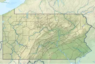 Location of Beatty Run mouth  Beatty Run (Sugar Creek tributary) (the United States) | |
| Location | |
| Country | United States |
| State | Pennsylvania |
| County | Venango |
| Physical characteristics | |
| Source | Deckard Run divide |
| • location | about 1 mile east of Deckard, Pennsylvania[2] |
| • coordinates | 41°31′23″N 079°56′35″W / 41.52306°N 79.94306°W[1] |
| • elevation | 1,340 ft (410 m)[2] |
| Mouth | Sugar Creek |
• location | about 1 mile north of Wyattville, Pennsylvania[2] |
• coordinates | 41°27′40″N 079°53′28″W / 41.46111°N 79.89111°W[1] |
• elevation | 1,070 ft (330 m)[2] |
| Length | 7.69 mi (12.38 km)[3] |
| Basin size | 8.64 square miles (22.4 km2)[4] |
| Discharge | |
| • location | Sugar Creek |
| • average | 15.27 cu ft/s (0.432 m3/s) at mouth with Sugar Creek[4] |
| Basin features | |
| Progression | southeast |
| River system | Allegheny River |
| Tributaries | |
| • left | McCauley Run |
| • right | unnamed tributaries |
Beatty Run is a 7.69 mi (12.38 km) long 2nd order tributary to Sugar Creek in Venango County, Pennsylvania.
Course
Beatty Run rises on the Deckard Run divide about 1 mile east of Deckard, Pennsylvania in Venango County. Beatty Run then flows southeast to meet Sugar Creek about 1 mile north of Wyattville, Pennsylvania in Venango County.[2]
Watershed
Beatty Run drains 8.64 square miles (22.4 km2) of area, receives about 44.3 in/year of precipitation, has a topographic wetness index of 418.12, and has an average water temperature of 7.93 °C.[4] The watershed is 71% forested.[4]
See also
References
- ^ a b "GNIS Detail - Beatty Run". geonames.usgs.gov. US Geological Survey. Retrieved 26 December 2019.
- ^ a b c d e "Sugar Creek Topo Map, Venango County PA (Utica Area)". TopoZone. Locality, LLC. Retrieved 26 December 2019.
- ^ "ArcGIS Web Application". epa.maps.arcgis.com. US EPA. Retrieved 26 December 2019.
- ^ a b c d "Beatty Run Watershed Report". Waters Geoviewer. US EPA. Retrieved 26 December 2019.
Additional Images
.jpg)
.jpg)