Bayeux (river)
| Bayeux | |
|---|---|
 | |
  | |
| Location | |
| Country | France |
| Physical characteristics | |
| Mouth | Arc |
• coordinates | 43°30′3″N 5°30′59″E / 43.50083°N 5.51639°E |
| Length | 10 km (6.2 mi) |
| Basin features | |
| Progression | Arc→ Étang de Berre→ Mediterranean Sea |
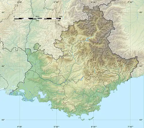
The Bayeux (French pronunciation: [bajø] ⓘ; Occitan: Baion) is a short stream in the southeast of France. In the upper 2 kilometres (1.2 mi) of its course it is called Bayon. It runs from the Montagne Sainte-Victoire[1] to the Arc, near Meyreuil. It is 10 km (6.2 mi) long.[2]
References
- ^ "Erudit Article" (PDF). Erudit.org. Retrieved 2013-12-05.
- ^ Sandre. "Fiche cours d'eau - Le Bayeux (Y4020540)".