Baillif Airport
Baillif Airport | |||||||||||
|---|---|---|---|---|---|---|---|---|---|---|---|
 | |||||||||||
| Summary | |||||||||||
| Airport type | Public | ||||||||||
| Serves | Basse Terre | ||||||||||
| Elevation AMSL | 64 ft / 20 m | ||||||||||
| Coordinates | 16°00′50″N 61°44′35″W / 16.01389°N 61.74306°W | ||||||||||
| Map | |||||||||||
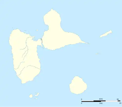 BBR Location of the airport in Guadeloupe | |||||||||||
| Runways | |||||||||||
| |||||||||||
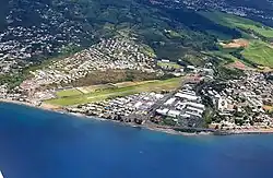
Baillif Airport (IATA: BBR, ICAO: TFFB) is an airport serving Basse Terre, a coastal city in Guadeloupe. The airport has high terrain north through southeast.
See also
References
- ^ Airport information for BBR at Great Circle Mapper.
- ^ Google Maps - Baillif
External links
- Picture 03/2020
- OpenStreetMap - Baillif
- OurAirports - Baillif
- SkyVector - Baillif
- Bing Maps - Baillif