Büddenstedt
Büddenstedt | |
|---|---|
 Coat of arms | |
Location of Büddenstedt | |
 Büddenstedt 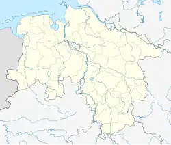 Büddenstedt | |
| Coordinates: 52°10′N 11°0′E / 52.167°N 11.000°E | |
| Country | Germany |
| State | Lower Saxony |
| District | Helmstedt |
| Town | Helmstedt |
| Area | |
• Total | 19.54 km2 (7.54 sq mi) |
| Elevation | 99 m (325 ft) |
| Population (2006-12-31) | |
• Total | 3,020 |
| • Density | 150/km2 (400/sq mi) |
| Time zone | UTC+01:00 (CET) |
| • Summer (DST) | UTC+02:00 (CEST) |
| Postal codes | 38372 |
| Dialling codes | 05352 |
| Vehicle registration | HE |
Büddenstedt is a former municipality in the district of Helmstedt, in Lower Saxony, Germany. It is situated approximately 6 km (4 miles) south of the town of Helmstedt into which it was incorporated on 1 July 2017 as a quarter.[1]
History
Büddenstedt was formed 1 March 1974 by combining the municipalities Neu Büddenstedt, Offleben, and Reinsdorf/Hohnsleben.[2] Neu Büddenstedt was settled in 1935 between a prior municipality named Büddenstedt and Wulfersdorf, both of which were slated for demolition due to coal mining. The previous Büddensted was finally fully evacuated in 1947 while Neu Büddensted became a municipality in 1950.[3]
-
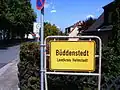 Büddenstedt
 -
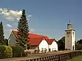
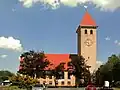 The Lutheran church
 -
 The Catholic church
References
- ^ ""Nichts in der Geschichte des Lebens ist beständiger als der Wandel"". Gemeinde Büdderstedt. Retrieved 26 July 2017.
- ^ Chronik der Einheitsgemeinde Büddenstedt 1974 – 2014 (PDF). Gemeinde Büddenstedt. pp. 4, 11. Retrieved 26 July 2017.
- ^ Chronik der Einheitsgemeinde Büddenstedt 1974 – 2014 (PDF). Gemeinde Büddenstedt. pp. 9, 11. Retrieved 26 July 2017.