Alpu
Alpu | |
|---|---|
District and municipality | |
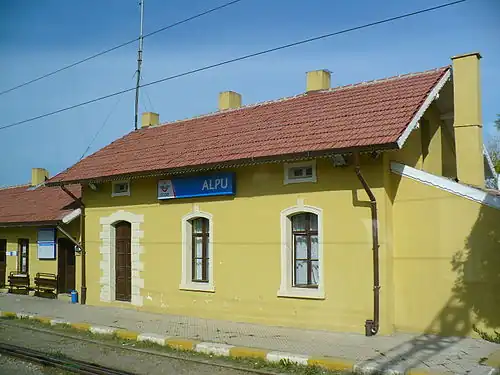 Alpu train station | |
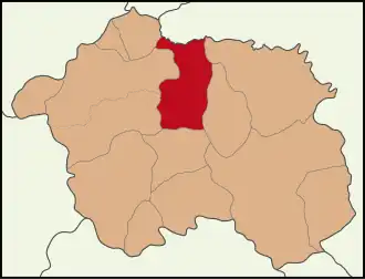 Map showing Alpu District in Eskişehir Province | |
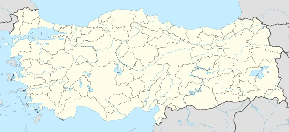 Alpu Location in Turkey  Alpu Alpu (Turkey Central Anatolia) | |
| Coordinates: 39°46′N 30°57′E / 39.767°N 30.950°E | |
| Country | Turkey |
| Province | Eskişehir |
| Government | |
| • Mayor | Gürbüz Güller (CHP) |
Area | 1,028 km2 (397 sq mi) |
| Elevation | 764 m (2,507 ft) |
| Population (2022)[1] | 9,966 |
| • Density | 9.7/km2 (25/sq mi) |
| Time zone | UTC+3 (TRT) |
| Postal code | 26630 |
| Area code | 0222 |
| Website | www |
Alpu (also: Alpıköy) is a municipality and district of Eskişehir Province, Turkey.[2] Its area is 1,028 km2,[3] and its population is 9,966 (2022).[1] The town lies at an elevation of 764 m (2,507 ft).[4]
Composition
There are 33 neighbourhoods in Alpu District:[5]
- Ağaçhisar
- Aktepe
- Alapınar
- Arıkaya
- Bahçecik
- Başören
- Belkese
- Bozan
- Büğdüz
- Çardakbaşı
- Çerkez Çukurhisar
- Dereköy
- Esence
- Fatih
- Fevzi Paşa
- Fevziye
- Gökçekaya
- Gökçeoğlu
- Güroluk
- Işıkören
- Karacaören
- Karakamış
- Kemalpaşa
- Koşmat
- Mamure
- Osmaniye
- Özdenk
- Sakarıkaracaören
- Sarıkavak
- Söğütçük
- Uyuzhamamköyü
- Yeşildon
- Yunusemre
References
- ^ a b "Address-based population registration system (ADNKS) results dated 31 December 2022, Favorite Reports" (XLS). TÜİK. Retrieved 12 July 2023.
- ^ Büyükşehir İlçe Belediyesi, Turkey Civil Administration Departments Inventory. Retrieved 12 July 2023.
- ^ "İl ve İlçe Yüz ölçümleri". General Directorate of Mapping. Retrieved 12 July 2023.
- ^ Falling Rain Genomics, Inc. "Geographical information on Alpu, Turkey". Retrieved 13 September 2023.
- ^ Mahalle, Turkey Civil Administration Departments Inventory. Retrieved 12 July 2023.
External links
Alpu in Eskişehir Province of Turkey | |||||||||||||||||||||||||||
|---|---|---|---|---|---|---|---|---|---|---|---|---|---|---|---|---|---|---|---|---|---|---|---|---|---|---|---|
| Districts |  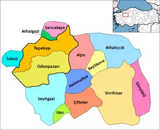 | ||||||||||||||||||||||||||
|
Metropolitan municipalities are bolded. | |||||||||||||||||||||||||||
| |||||||||||||||||||
| |||||||||||||||||||
| |||||||||||||||||||