Adelino, New Mexico
Adelino, New Mexico | |
|---|---|
Census-designated place | |
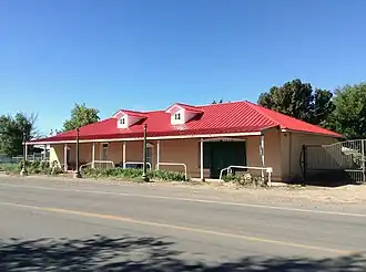 The historic Miguel E. Baca House in Adelino | |
 Adelino, New Mexico | |
| Coordinates: 34°42′22″N 106°44′25″W / 34.70611°N 106.74028°W | |
| Country | United States |
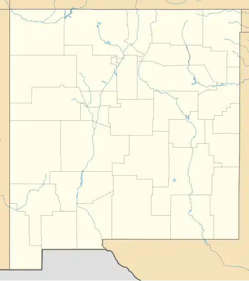
| State | New Mexico |
| County | Valencia |
| Area | |
• Total | 2.98 sq mi (7.73 km2) |
| • Land | 2.98 sq mi (7.73 km2) |
| • Water | 0.00 sq mi (0.00 km2) |
| Elevation | 4,820 ft (1,470 m) |
| Population | |
• Total | 735 |
| • Density | 246.31/sq mi (95.10/km2) |
| Time zone | UTC-7 (Mountain (MST)) |
| • Summer (DST) | UTC-6 (MDT) |
| Area code | 505 |
| GNIS feature ID | 2584044[2] |
Adelino is a census-designated place in Valencia County, New Mexico, United States. Its population was 783 as of the 2020 census.[4] The Adelino CDP was first made in the 2010 census when it had a population of 823.[5] Prior to 2010, the community was part of the Tome-Adelino CDP.
Adelino contains the historic Miguel E. Baca House, listed on the National Register of Historic Places.
Demographics
| Census | Pop. | Note | %± |
|---|---|---|---|
| 2020 | 735 | — | |
| U.S. Decennial Census[6][3] | |||
Education
Its school district is Belén Consolidated Schools.[7] Belén High School is the district's comprehensive high school.
References
- ^ "ArcGIS REST Services Directory". United States Census Bureau. Retrieved October 12, 2022.
- ^ a b U.S. Geological Survey Geographic Names Information System: Adelino, New Mexico
- ^ a b "Census Population API". United States Census Bureau. Retrieved October 12, 2022.
- ^ "U.S. Census website". United States Census Bureau. Retrieved May 19, 2022.
- ^ "U.S. Census website". United States Census Bureau. Retrieved May 14, 2011.
- ^ "Census of Population and Housing". Census.gov. Retrieved June 4, 2016.
- ^ "2020 CENSUS - SCHOOL DISTRICT REFERENCE MAP: Valencia County, NM" (PDF). U.S. Census Bureau. Retrieved September 4, 2022.
Municipalities and communities of Valencia County, New Mexico, United States | ||
|---|---|---|
| Cities |  | |
| Town | ||
| Villages | ||
| CDPs | ||
| Unincorporated community | ||